Our curriculum sets out: the significant and key knowledge that pupils should know and remember as well as the skills that the children will develop and build on; the key concepts that children will return to in different contexts and year groups; the prior learning that the children can build on; the vocabulary that will be introduced as well as the sequencing and progression of the units to be taught.
The Geography Curriculum at Cleobury Mortimer Primary School aims to inspire pupils to become curious and explorative thinkers with a diverse knowledge of the world; in other words, to think like a geographer. We want pupils to develop the confidence to question and observe places, measure and record necessary data in various ways, and analyse and present their findings.
Through our scheme of work, we aim to build an awareness of how Geography shapes our lives at multiple scales and over time. We hope to encourage pupils to become resourceful, active citizens who will have the skills to contribute to and improve the world around them.
Our scheme encourages:
• A strong focus on developing both geographical skills and knowledge.
• Critical thinking, with the ability to ask perceptive questions and explain and analyse evidence.
• The development of fieldwork skills across each year group.
• A deep interest and knowledge of pupils’ locality and how it differs from other areas of the world.
• A growing understanding of geographical terms and vocabulary.
Cleobury Mortimer Primary School’s Geography Curriculum enables pupils to meet the end of key stage attainment targets in the National Curriculum. The aims also align with those in the National Curriculum.
Implementation:
The National curriculum organises the Geography attainment targets under four subheadings or strands:
• Locational knowledge
• Place knowledge
• Human and physical geography
• Geographical skills and fieldwork
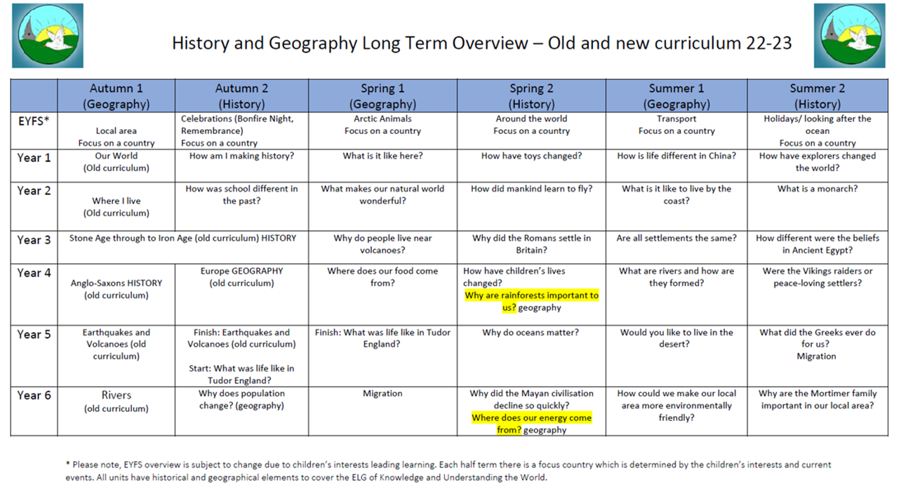
Our Geography Curriculum has a clear progression of skills and knowledge within these four strands across each year group. Our Progression of skills and knowledge shows the skills taught within each year group and how these develop to ensure that attainment targets are securely met by the end of each key stage. Our scheme is a spiral curriculum, with essential knowledge and skills revisited with increasing complexity, allowing pupils to revise and build on their previous learning. Locational knowledge, in particular, will be reviewed in each unit to coincide with our belief that this will consolidate children’s understanding of key concepts, such as scale and place, in geography lessons. Cross-curricular links are included throughout each unit, allowing children to make connections and apply their geographical skills to other areas of learning.
At Cleobury Mortimer Primary School, geography is studied once per term over six lessons, alternating each half term with history units. This allows children to have a clear understanding of what geography is. Each geography unit is formed around an enquiry question, meaning that pupils gain a solid understanding of geographical knowledge and skills by applying them to answer enquiry questions. In attempting to answer them, children learn how to collect, interpret and present data using geographical methodologies and fieldwork and make informed decisions by applying their geographical knowledge.
Each unit contains elements of geographical skills and fieldwork to ensure that fieldwork skills are practised as often as possible. Our units follow an enquiry cycle that maps out the fieldwork process of question, observe, measure, record, and present, to reflect the elements mentioned in the National Curriculum. This ensures children will learn how to decide on an area of enquiry, plan to measure data using a range of methods, capture the data and present it to a range of appropriate stakeholders in various formats.
Fieldwork includes smaller opportunities on the school grounds to larger-scale visits to investigate physical and human features. Developing fieldwork skills within the school environment and revisiting them in multiple units enables pupils to consolidate their understanding of various methods. It also gives children the confidence to evaluate methodologies without always having to leave the school grounds and do so within the confines of a familiar place. This makes fieldwork regular and accessible while giving children a thorough understanding of their locality, providing a solid foundation when comparing it with other places.
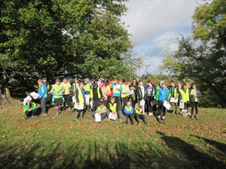
In the Summer Term each year, every class from EYFS to Year 6 will take part in ‘Locality Week’. This involves a study of the local area, with each class having a different focus from the local area. Children partake in enquiry-based learning, asking a question that they would like to answer about the geography of the local area. A key element of this week is fieldwork. Children complete a fieldwork activity to apply the geographical skills they have learnt in their lessons. As the fieldwork is local, it allows for all children to access the learning and build the skills they need to be successful geographers.
Lessons incorporate various teaching strategies from independent tasks to paired and group work, including practical hands-on, computer-based and collaborative tasks. Consideration for all learners is made in each lesson, with added support or extensions being used to allow for inclusion of all learners. Knowledge organisers for each unit support pupils in building a foundation of factual knowledge by encouraging recall of key facts and vocabulary. Each unit begins with a skills or knowledge catcher activity, this activity is completed at the beginning and end of each unit, allowing for clear progression to be seen in topic books.
Strong subject knowledge is vital for staff to be able to deliver a highly-effective and robust geography curriculum. Each unit of lessons will focus on the key subject knowledge needed to deliver the curriculum, making links with prior learning and identifying possible misconceptions.
National Curriculum expectations for geography. Each lesson teachers assess pupils against the learning objectives, showing this as successfully met with a green highlighter over the ‘LO’. Furthermore, each unit has a unit quiz that can be used at the start or end of the unit to asses children’s understanding and a skills or knowledge catcher which can be used at the end of the unit to provide a summative assessment. Opportunities for children to present their findings using their geographical skills will also form part of the assessment process in each unit.
At the end of each unit, teachers fill in an assessment record against the key knowledge that has been identified for each unit. Children who have not met or have exceeded the expected understanding of this knowledge are recorded at the end of each unit. This information is then used to give teachers a starting point for any subsequent units that build on this knowledge. This ensures that key concepts are embedded later on in learning and children have not missed out on key knowledge.
After their years of geography at Cleobury Mortimer Primary School, pupils should leave school equipped with a range of skills and knowledge to enable them to study geography with confidence at Key stage 3. We hope to shape children into curious and inspired geographers with respect and appreciation for the world around them alongside an understanding of the interconnection between the human and the physical.
The expected impact of following our Geography Curriculum is that children will:
• Compare and contrast human and physical features to describe and understand similarities and differences between various places in the UK, Europe and the Americas.
• Name, locate and understand where and why the physical elements of our world are located and how they interact, including processes over time relating to climate, biomes, natural disasters and the water cycle.
• Understand how humans use land for economic and trading purposes, including how the distribution of natural resources has shaped this.
• Develop an appreciation for how humans are impacted by and have evolved around the physical geography surrounding them and how humans have had an impact on the environment, both positive and negative.
• Develop a sense of location and place around the UK and some areas of the wider world using the eight-points of a compass, four and six-figure grid references, symbols and keys on maps, globes, atlases, aerial photographs and digital mapping
• Identify and understand how various elements of our globe create positioning, including latitude, longitude, the hemispheres, the tropics and how time zones work, including night and day.
• Present and answer their own geographical enquiries using planned and specifically chosen methodologies, collected data and digital technologies.
• Meet the end of key stage expectations outlined in the National curriculum for Geography.
The image below will take you to books about geography.
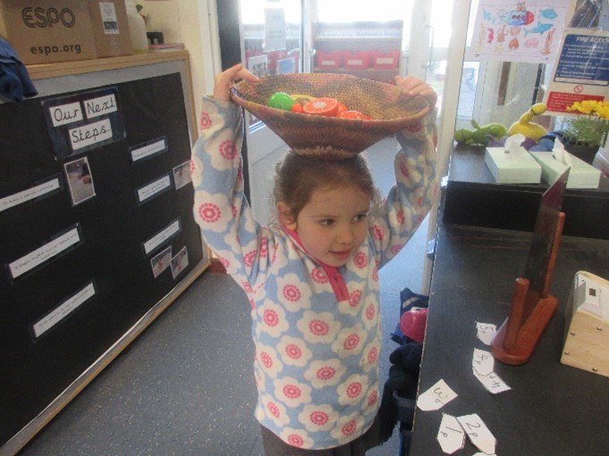
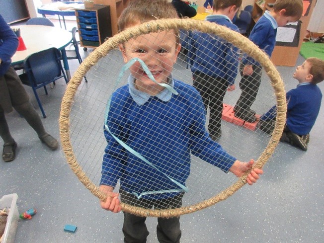
After reading the story of Handa's Surprise, children looked at the continent of Africa. They found it on a map and then compared life in some places in Africa to life in Cleobury Mortimer.
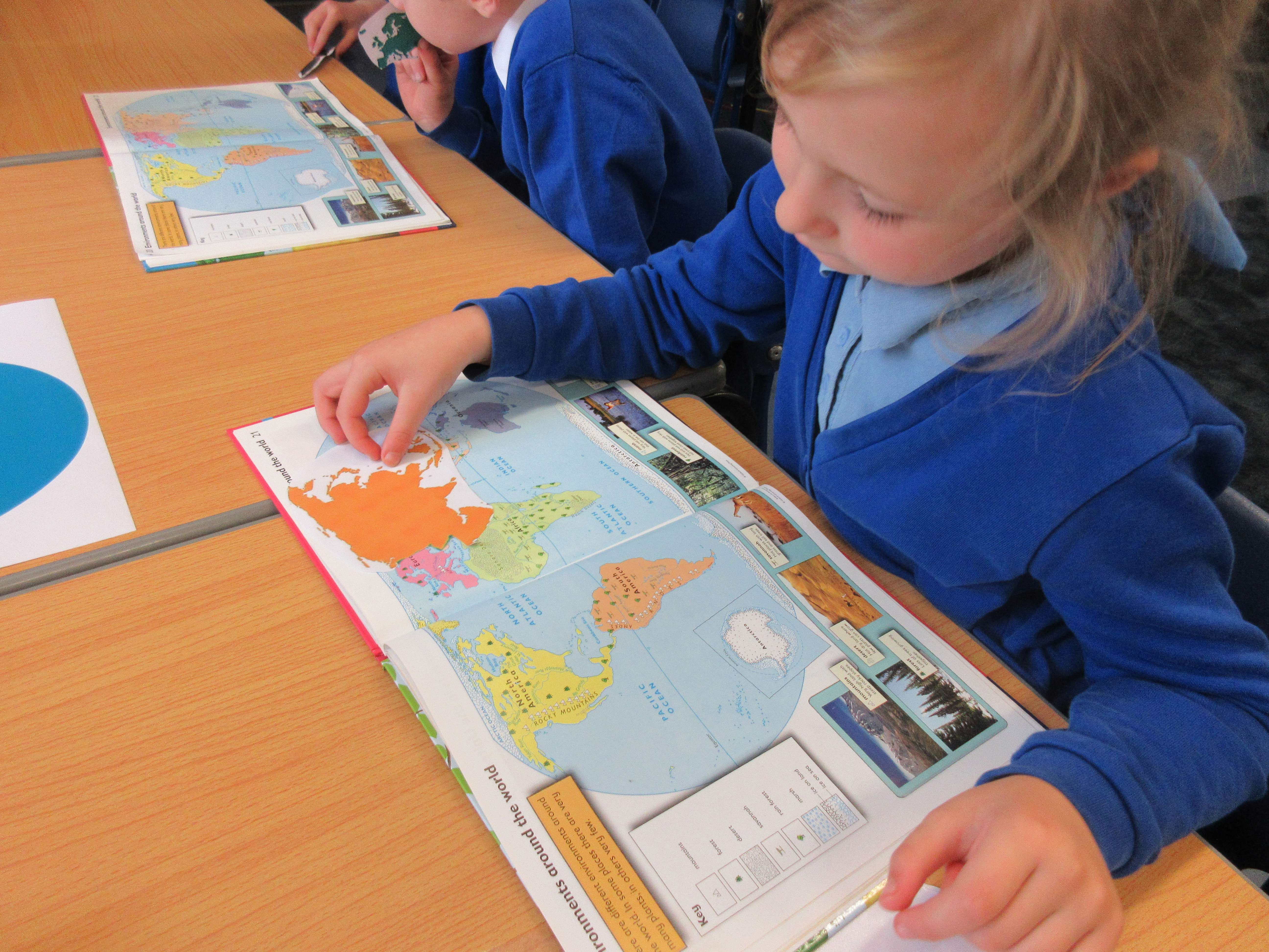
The children have used atlases to explore where they are in the world. They have located the UK on a world map and have begun to explore the countries and capital cities that make up the UK.
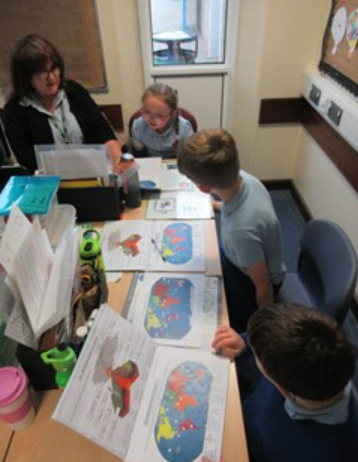
Year 5 have used maps in their Volcanoes topic to find and locate the world's most well-known volcanoes.
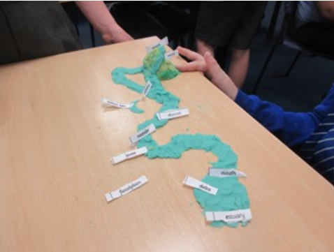
The children have used very creative ways to explore rivers and the water cycle. They have used playdough and sandwich bags to represent the water cycle in different ways.
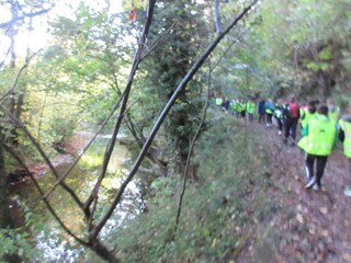
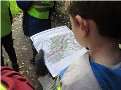
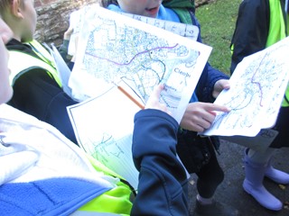
To help the children learn about rivers, Mole Class and Deer Class visited our local river, the River Rea. They used maps to help them navigate and realised how landmarks, symbols and contour lines can be helpful.
As they walked along the river, the children observed that the river was quite narrow, shallow and relatively slow moving. They also noticed signs of erosion and deposition. They observed many features including: a waterfall, meander, erosion and deposition.
After looking at the evidence, they decided that we were probably looking at the middle course.
The children discovered that the River Rea is a tributary which means that it flows into another river. Upon their return to school, they used an atlas to find out which river it is.